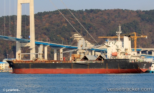
 NAVI SUNNY
Current Status
Where is the vessel?
NAVI SUNNY is currently in 80 nm W of Dehiwala, based on AIS data received about 15h ago.
Latest AIS update:
Current position: 6.88833° N, 78.50833° E (80 nm W of Dehiwala)
Average speed (last 7 days): Loading…
Average speed (last 30 days): Loading…
Vessel profile: NAVI SUNNY is a Cargo with dimensions m x m.
This page combines live AIS, route history, probable destination signals, nearby traffic, and port activity for practical vessel monitoring.
The current position of vessel NAVI SUNNY is 6.88833 lat / 78.50833 lng. Updated: 2026-05-19 23:33:52 UTCNearest reference points:
- 94 nm W of Dehiwala
- 90 nm W of Moratuwa
- 82 nm W of Moratuwa
Currently sailing under the flag of Tuvalu ![]()
Details:
Live Vessel NAVI SUNNY Analytics (details, animations, etc.)
Recent AIS points (UTC):
2026-05-19 19:51:53 UTC · 6.55333, 79.03833 · SOG 10 kn · COG -1°2026-05-19 21:39:49 UTC · 6.71833, 78.77833 · SOG 9 kn · COG -1°
2026-05-19 21:48:53 UTC · 6.73167, 78.75667 · SOG 10 kn · COG -1°
2026-05-19 23:33:52 UTC · 6.88833, 78.50833 · SOG 10 kn · COG -1°