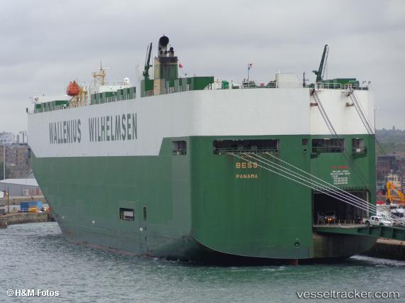
 BESS
BESS
Current Status
Where is the vessel?
BESS is currently in Open sea (no nearby ports in database), based on AIS data received about 14h ago.
Latest AIS update:
Current position: 37.05719° N, 160.22643° W (Open sea (no nearby ports in database))
Average speed (last 7 days): Loading…
Average speed (last 30 days): Loading…
Vessel profile: BESS is a Vehicles Carrier with dimensions m x m.
This page combines live AIS, route history, probable destination signals, nearby traffic, and port activity for practical vessel monitoring.
The current position of vessel BESS is 37.05719 lat / -160.22643 lng. Updated: 2026-05-20 13:42:17 UTCNearest reference points:
- Open sea (no nearby ports in database)
Currently sailing under the flag of Norway ![]()
Details:
Live Vessel BESS Analytics (details, animations, etc.)
Recent AIS points (UTC):
2026-05-20 10:01:10 UTC · 36.64216, -158.88304 · SOG 18.2 kn · COG 293°2026-05-20 11:51:59 UTC · 36.84496, -159.54567 · SOG 18.7 kn · COG 292°
2026-05-20 13:42:17 UTC · 37.05719, -160.22643 · SOG 19.4 kn · COG 294°
2026-05-20 13:42:17 UTC · 37.05719, -160.22643 · SOG 19.4 kn · COG 294°