 LOGINDO ENERGY
Current Status
Where is the vessel?
LOGINDO ENERGY is currently in Near BATU AMPAR, based on AIS data received about 14h ago.
Latest AIS update:
Current position: 1.16251° N, 103.97860° E (Near BATU AMPAR)
Average speed (last 7 days): Loading…
Average speed (last 30 days): Loading…
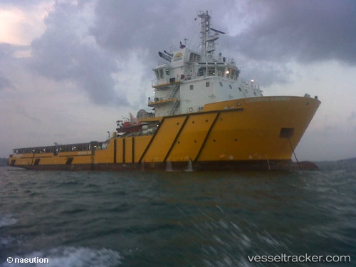
Vessel profile: LOGINDO ENERGY is a Offshore Tug/Supply Ship with dimensions 15m x 78m.
This page combines live AIS, route history, probable destination signals, nearby traffic, and port activity for practical vessel monitoring.
The current position of vessel LOGINDO ENERGY is 1.16251 lat / 103.97860 lng. Updated: 2026-05-19 21:27:31 UTCNearest reference points:
- Near BATU AMPAR
- Near Sambu
- Near Sekupang
Currently sailing under the flag of Indonesia ![]()
LOGINDO ENERGY built in 2013 year
Deadweight:
3307 tDetails:
Live Vessel LOGINDO ENERGY Analytics (details, animations, etc.)
Recent AIS points (UTC):
2026-05-19 18:12:35 UTC · 1.16251, 103.97864 · SOG 0 kn · COG 230°2026-05-19 19:18:34 UTC · 1.16247, 103.97861 · SOG 0 kn · COG 229°
2026-05-19 20:15:50 UTC · 1.16167, 103.97833 · SOG 0 kn · COG -1°
2026-05-19 21:27:31 UTC · 1.16251, 103.97860 · SOG 0 kn · COG 225°