 HANSA DUBURG
Current Status
Where is the vessel?
HANSA DUBURG is currently in Open sea, approx. 405 nm off the nearest listed port, based on AIS data received about 14h ago.
Latest AIS update:
Current position: 34.71323° N, 175.26933° W (Open sea, approx. 405 nm off the nearest listed port)
Average speed (last 7 days): Loading…
Average speed (last 30 days): Loading…
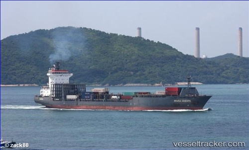
Vessel profile: HANSA DUBURG is a Cargo with dimensions m x m.
This page combines live AIS, route history, probable destination signals, nearby traffic, and port activity for practical vessel monitoring.
The current position of vessel HANSA DUBURG is 34.71323 lat / -175.26933 lng. Updated: 2026-05-22 22:13:37 UTCNearest reference points:
- Open sea, approx. 405 nm off the nearest listed port
- Open sea, approx. 401 nm off the nearest listed port
- Open sea, approx. 400 nm off the nearest listed port
Currently sailing under the flag of Portugal ![]()
Details:
Live Vessel HANSA DUBURG Analytics (details, animations, etc.)
Recent AIS points (UTC):
2026-05-22 19:57:19 UTC · 34.88167, -174.55499 · SOG 16 kn · COG -1°2026-05-22 20:11:33 UTC · 34.86570, -174.62943 · SOG 15.8 kn · COG 254°
2026-05-22 21:37:55 UTC · 34.75859, -175.08076 · SOG 16.2 kn · COG 253°
2026-05-22 22:13:37 UTC · 34.71323, -175.26933 · SOG 16.5 kn · COG 252°