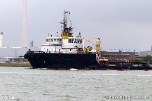
Britoil 120
Current StatusWhere is the vessel?
Britoil 120 is currently in Near Ras Tannurah, based on AIS data received about 14h ago.
Latest AIS update:
Current position: 26.60518° N, 50.21306° E (Near Ras Tannurah)
Average speed (last 7 days): Loading…
Average speed (last 30 days): Loading…
Vessel profile: Britoil 120 is a Offshore Tug Supply Ship with dimensions 16m x 49m.
This page combines live AIS, route history, probable destination signals, nearby traffic, and port activity for practical vessel monitoring.
The current position of vessel Britoil 120 is 26.60518 lat / 50.21306 lng. Updated: 2026-05-22 04:33:34 UTCNearest reference points:
- Near Ad Dammam
- Near DAMMAM
- Near Sayhat
Details:
Live Vessel Britoil 120 Analytics (details, animations, etc.)
Recent AIS points (UTC):
2026-05-22 01:44:54 UTC · 26.62973, 50.25411 · SOG 2.5 kn · COG 222°2026-05-22 02:23:05 UTC · 26.61531, 50.22700 · SOG 2.9 kn · COG 254°
2026-05-22 03:39:54 UTC · 26.60586, 50.21288 · SOG 0 kn · COG 26°
2026-05-22 04:33:34 UTC · 26.60518, 50.21306 · SOG 0 kn · COG 16°