 XINGTONG 799
Current Status
Where is the vessel?
XINGTONG 799 is currently in 62 nm NE of Tongdaemun-Gu, based on AIS data received about 14h ago.
Latest AIS update:
Current position: 37.06985° S, 128.17706° E (62 nm NE of Tongdaemun-Gu)
Average speed (last 7 days): Loading…
Average speed (last 30 days): Loading…
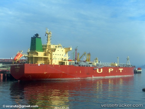
Vessel profile: XINGTONG 799 is a Chemical/Oil Products Tanker with dimensions 182m x 32m.
This page combines live AIS, route history, probable destination signals, nearby traffic, and port activity for practical vessel monitoring.
The current position of vessel XINGTONG 799 is -37.06985 lat / 128.17706 lng. Updated: 2026-05-20 19:05:08 UTCCurrently sailing under the flag of China Peopless Republic ![]()
XINGTONG 799 built in 2011 year
Deadweight:
49962 tDetails:
Live Vessel XINGTONG 799 Analytics (details, animations, etc.)
Recent AIS points (UTC):
2026-05-20 15:51:58 UTC · -36.96578, 127.41383 · SOG 11 kn · COG 99°2026-05-20 17:07:19 UTC · -37.00930, 127.70852 · SOG 11.5 kn · COG 100°
2026-05-20 18:19:32 UTC · -37.04500, 127.99333 · SOG 11 kn · COG -1°
2026-05-20 19:05:08 UTC · -37.06985, 128.17706 · SOG 11.7 kn · COG 99°