 vesseltracker.com
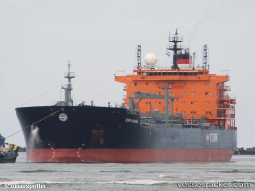
 TORM ANABEL
Current Status
Where is the vessel?
TORM ANABEL is currently in 20 nm SE of Paranagua, based on AIS data received about 14h ago.
Latest AIS update:
Current position: 25.67990° S, 48.21057° W (20 nm SE of Paranagua)
Average speed (last 7 days): Loading…
Average speed (last 30 days): Loading…
Vessel profile: TORM ANABEL is a Chemical/Oil Products Tanker with dimensions 32m x 183m.
This page combines live AIS, route history, probable destination signals, nearby traffic, and port activity for practical vessel monitoring.
The current position of vessel TORM ANABEL is -25.67990 lat / -48.21057 lng. Updated: 2026-05-17 22:34:41 UTCNearest reference points:
- 24 nm E of Caioba
- 32 nm E of Caioba
- 10 nm NE of CAMBORIU
Currently sailing under the flag of Denmark (DIS) ![]()
TORM ANABEL built in 2012 year
Deadweight:
49999 tDetails:
Live Vessel TORM ANABEL Analytics (details, animations, etc.)
Recent AIS points (UTC):
2026-05-17 19:34:38 UTC · -25.68016, -48.21178 · SOG 0.1 kn · COG 132°2026-05-17 19:49:38 UTC · -25.67995, -48.21148 · SOG 0.1 kn · COG 152°
2026-05-17 21:52:38 UTC · -25.68046, -48.20971 · SOG 0.1 kn · COG 234°
2026-05-17 22:34:41 UTC · -25.67990, -48.21057 · SOG 0.1 kn · COG 192°