 CATTLEYA ACE
Current Status
Where is the vessel?
CATTLEYA ACE is currently in Near HAMBANTOTA, based on AIS data received about 14h ago.
Latest AIS update:
Current position: 6.12958° N, 81.09269° E (Near HAMBANTOTA)
Average speed (last 7 days): Loading…
Average speed (last 30 days): Loading…
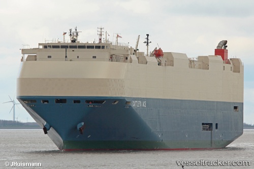
Vessel profile: CATTLEYA ACE is a Vehicles Carrier with dimensions 199m x 32m.
This page combines live AIS, route history, probable destination signals, nearby traffic, and port activity for practical vessel monitoring.
The current position of vessel CATTLEYA ACE is 6.12958 lat / 81.09269 lng. Updated: 2026-05-19 01:22:04 UTCNearest reference points:
- Near HAMBANTOTA
- 15 nm S of Koggala
- 40 nm E of Konwelana
Currently sailing under the flag of Japan ![]()
CATTLEYA ACE built in 2011 year
Deadweight:
16384 tDetails:
Live Vessel CATTLEYA ACE Analytics (details, animations, etc.)
Recent AIS points (UTC):
2026-05-18 22:13:04 UTC · 6.12957, 81.09275 · SOG 0 kn · COG 91°2026-05-18 22:19:04 UTC · 6.12956, 81.09275 · SOG 0.1 kn · COG 91°
2026-05-18 23:25:04 UTC · 6.12958, 81.09272 · SOG 0.1 kn · COG 91°
2026-05-19 01:22:04 UTC · 6.12958, 81.09269 · SOG 0.1 kn · COG 91°