 MAGIC TWILIGHT
Current Status
Where is the vessel?
MAGIC TWILIGHT is currently in 10 nm S of Guarujá, based on AIS data received about 14h ago.
Latest AIS update:
Current position: 24.16758° S, 46.28517° W (10 nm S of Guarujá)
Average speed (last 7 days): Loading…
Average speed (last 30 days): Loading…
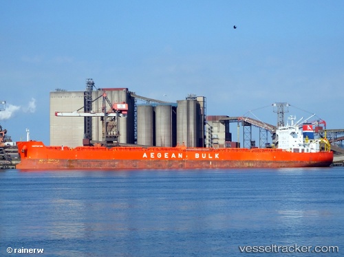
Vessel profile: MAGIC TWILIGHT is a Bulk Carrier with dimensions 32m x 229m.
This page combines live AIS, route history, probable destination signals, nearby traffic, and port activity for practical vessel monitoring.
The current position of vessel MAGIC TWILIGHT is -24.16758 lat / -46.28517 lng. Updated: 2026-05-19 02:10:36 UTCNearest reference points:
- Near Guarujá
- Near Santos
- 36 nm S of Guarujá
Currently sailing under the flag of Marshall Islands ![]()
MAGIC TWILIGHT built in 2010 year
Deadweight:
80700 tDetails:
Live Vessel MAGIC TWILIGHT Analytics (details, animations, etc.)
Recent AIS points (UTC):
2026-05-18 22:20:59 UTC · -24.16667, -46.28500 · SOG 0 kn · COG -1°2026-05-19 00:25:24 UTC · -24.16770, -46.28505 · SOG 0.3 kn · COG 225°
2026-05-19 01:58:23 UTC · -24.16748, -46.28537 · SOG 0 kn · COG 211°
2026-05-19 02:10:36 UTC · -24.16758, -46.28517 · SOG 0.1 kn · COG -1°