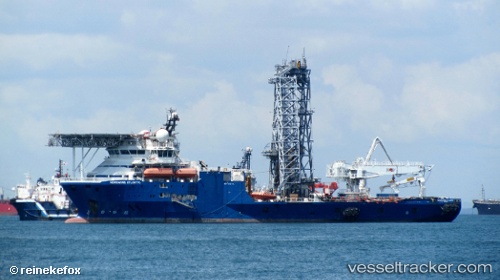
 BOKA ATLANTIC
Current Status
Where is the vessel?
BOKA ATLANTIC is currently in 15 nm W of Chang-Hua, based on AIS data received about 15h ago.
Latest AIS update:
Current position: 24.11134° N, 120.24443° E (15 nm W of Chang-Hua)
Average speed (last 7 days): Loading…
Average speed (last 30 days): Loading…
Vessel profile: BOKA ATLANTIC is a Dredging or underwater ops with dimensions m x m.
This page combines live AIS, route history, probable destination signals, nearby traffic, and port activity for practical vessel monitoring.
The current position of vessel BOKA ATLANTIC is 24.11134 lat / 120.24443 lng. Updated: 2026-05-20 07:51:27 UTCNearest reference points:
- Near TAICHUNG
- Near Tai-tung Kang
- Near MAILIAO
Currently sailing under the flag of Malta ![]()
Details:
Live Vessel BOKA ATLANTIC Analytics (details, animations, etc.)
Recent AIS points (UTC):
2026-05-20 04:13:16 UTC · 24.11117, 120.24402 · SOG 0 kn · COG 30°2026-05-20 05:39:06 UTC · 24.11105, 120.24363 · SOG 0.2 kn · COG 43°
2026-05-20 07:49:57 UTC · 24.11135, 120.24443 · SOG 0 kn · COG 88°
2026-05-20 07:51:27 UTC · 24.11134, 120.24443 · SOG 0 kn · COG 88°