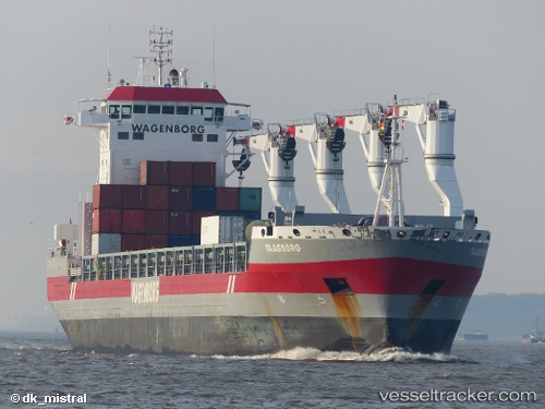
 Taagborg
Current Status
Where is the vessel?
Taagborg is currently in 50 nm SE of NANTUCKET, based on AIS data received about 14h ago.
Latest AIS update:
Current position: 40.57729° N, 69.51733° W (50 nm SE of NANTUCKET)
Average speed (last 7 days): Loading…
Average speed (last 30 days): Loading…
Vessel profile: Taagborg is a Multi Purpose Carrier with dimensions 173m x 173m.
This page combines live AIS, route history, probable destination signals, nearby traffic, and port activity for practical vessel monitoring.
The current position of vessel Taagborg is 40.57729 lat / -69.51733 lng. Updated: 2026-06-12 23:47:58 UTCNearest reference points:
- 28 nm SE of East Harwich
- 19 nm S of Chilmark
- Near South Yarmouth
Currently sailing under the flag of Netherlands ![]()
Taagborg built in 2013 year
Deadweight:
21338 tDetails:
Live Vessel Taagborg Analytics (details, animations, etc.)
Recent AIS points (UTC):
2026-06-12 19:48:24 UTC · 40.76333, -68.52833 · SOG 13 kn · COG -1°2026-06-12 21:25:15 UTC · 40.65840, -68.95396 · SOG 11.9 kn · COG 247°
2026-06-12 22:44:56 UTC · 40.58584, -69.27678 · SOG 11.6 kn · COG 264°
2026-06-12 23:47:58 UTC · 40.57729, -69.51733 · SOG 9.7 kn · COG 264°