 vesseltracker.com
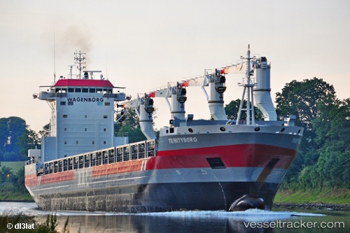
 Trinityborg
Current Status
Where is the vessel?
Trinityborg is currently in Near Port Aransas, based on AIS data received about 15h ago.
Latest AIS update:
Current position: 27.82667° N, 96.89667° W (Near Port Aransas)
Average speed (last 7 days): Loading…
Average speed (last 30 days): Loading…
Vessel profile: Trinityborg is a Multi Purpose Carrier with dimensions 173m x 22m.
This page combines live AIS, route history, probable destination signals, nearby traffic, and port activity for practical vessel monitoring.
The current position of vessel Trinityborg is 27.82667 lat / -96.89667 lng. Updated: 2026-05-18 05:32:41 UTCNearest reference points:
- 10 nm E of Port Aransas
- Near Port Aransas
- Near PORT ARANSAS
Currently sailing under the flag of Netherlands ![]()
Trinityborg built in 2013 year
Deadweight:
21277 tDetails:
Live Vessel Trinityborg Analytics (details, animations, etc.)
Recent AIS points (UTC):
2026-05-18 01:44:07 UTC · 27.82602, -96.89680 · SOG 0.1 kn · COG 149°2026-05-18 04:08:09 UTC · 27.82593, -96.89696 · SOG 0.1 kn · COG 143°
2026-05-18 04:50:37 UTC · 27.82667, -96.89667 · SOG 0 kn · COG -1°
2026-05-18 05:32:41 UTC · 27.82667, -96.89667 · SOG 0 kn · COG -1°