 vesseltracker.com
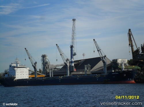
 BARBRO G
Current Status
Where is the vessel?
BARBRO G is currently in Near Cacouna, based on AIS data received less than 1h ago.
Latest AIS update:
Current position: 48.02717° N, 69.63165° W (Near Cacouna)
Average speed (last 7 days): Loading…
Average speed (last 30 days): Loading…
Vessel profile: BARBRO G is a Bulk Carrier with dimensions 190m x 24m.
This page combines live AIS, route history, probable destination signals, nearby traffic, and port activity for practical vessel monitoring.
The current position of vessel BARBRO G is 48.02717 lat / -69.63165 lng. Updated: 2026-05-15 00:11:53 UTCNearest reference points:
- Near Ile Aux Coudres
- 15 nm NW of Saint-Anaclet
- Near QUEBEC
Currently sailing under the flag of Portugal (MAR) ![]()
BARBRO G built in 2010 year
Deadweight:
29975 tDetails:
Live Vessel BARBRO G Analytics (details, animations, etc.)
Recent AIS points (UTC):
2026-05-14 19:36:21 UTC · 47.31602, -70.50803 · SOG 8.6 kn · COG 29°2026-05-14 19:46:53 UTC · 47.33910, -70.49129 · SOG 9 kn · COG 23°
2026-05-14 21:50:53 UTC · 47.58750, -70.07883 · SOG 13.3 kn · COG 40°
2026-05-15 00:11:53 UTC · 48.02717, -69.63165 · SOG 15.1 kn · COG 30°