 vesseltracker.com
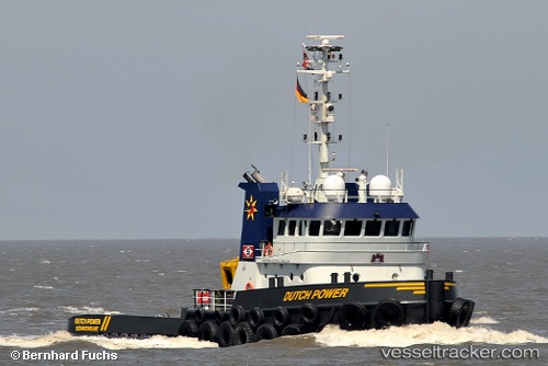
 Dutch Power
Current Status
Where is the vessel?
Dutch Power is currently in Near BRUINISSE, based on AIS data received less than 1h ago.
Latest AIS update:
Current position: 51.65161° N, 4.09890° E (Near BRUINISSE)
Average speed (last 7 days): Loading…
Average speed (last 30 days): Loading…
Vessel profile: Dutch Power is a Tug with dimensions 30m x 31m.
This page combines live AIS, route history, probable destination signals, nearby traffic, and port activity for practical vessel monitoring.
The current position of vessel Dutch Power is 51.65161 lat / 4.09890 lng. Updated: 2026-05-14 05:44:55 UTCNearest reference points:
- Near BRUINISSE
- Near HERKINGEN
- Near Sirjansland
Currently sailing under the flag of Netherlands ![]()
Dutch Power built in 2009 year
Deadweight:
130 tDetails:
Live Vessel Dutch Power Analytics (details, animations, etc.)
Recent AIS points (UTC):
2026-05-14 01:29:56 UTC · 51.65162, 4.09891 · SOG 0.2 kn · COG 115°2026-05-14 03:42:36 UTC · 51.65165, 4.09893 · SOG 0.1 kn · COG 114°
2026-05-14 04:33:22 UTC · 51.65139, 4.09884 · SOG 0.9 kn · COG 114°
2026-05-14 05:44:55 UTC · 51.65161, 4.09890 · SOG 0 kn · COG 115°