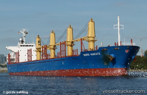
Nord Hakata
Current StatusWhere is the vessel?
Nord Hakata is currently in Near Santan Terminal, based on AIS data received about 14h ago.
Latest AIS update:
Current position: 0.22188° S, 117.55670° E (Near Santan Terminal)
Average speed (last 7 days): Loading…
Average speed (last 30 days): Loading…
Vessel profile: Nord Hakata is a Bulk Carrier with dimensions 27m x 169m.
This page combines live AIS, route history, probable destination signals, nearby traffic, and port activity for practical vessel monitoring.
The current position of vessel Nord Hakata is -0.22188 lat / 117.55670 lng. Updated: 2026-05-21 01:49:49 UTCNearest reference points:
- Near Santan Terminal
- 16 nm SE of Santan Terminal
- 22 nm NE of Handil
Details:
Live Vessel Nord Hakata Analytics (details, animations, etc.)
Recent AIS points (UTC):
2026-05-20 17:43:46 UTC · -0.21982, 117.55617 · SOG 0.1 kn · COG 212°2026-05-20 17:43:46 UTC · -0.21982, 117.55617 · SOG 0.1 kn · COG 212°
2026-05-20 23:58:46 UTC · -0.22045, 117.55665 · SOG 0 kn · COG 237°
2026-05-21 01:49:49 UTC · -0.22188, 117.55670 · SOG 0 kn · COG 307°