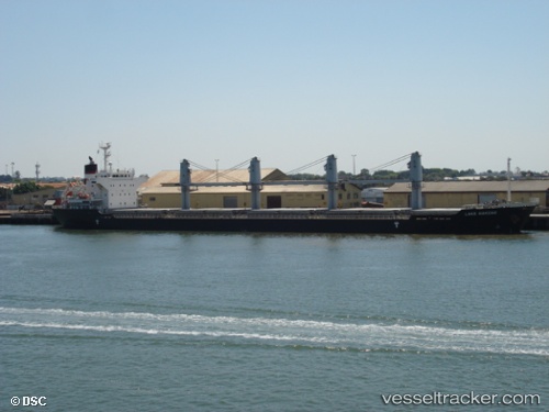
 LADY AILLAR
Current Status
Where is the vessel?
LADY AILLAR is currently in 202 nm W of Georgetown, based on AIS data received about 14h ago.
Latest AIS update:
Current position: 6.96682° S, 17.67595° W (202 nm W of Georgetown)
Average speed (last 7 days): Loading…
Average speed (last 30 days): Loading…
Vessel profile: LADY AILLAR is a Bulk Carrier with dimensions m x m.
This page combines live AIS, route history, probable destination signals, nearby traffic, and port activity for practical vessel monitoring.
The current position of vessel LADY AILLAR is -6.96682 lat / -17.67595 lng. Updated: 2026-06-16 18:11:41 UTCCurrently sailing under the flag of Barbados ![]()
Details:
Live Vessel LADY AILLAR Analytics (details, animations, etc.)
Recent AIS points (UTC):
2026-06-16 13:49:33 UTC · -6.51117, -16.99598 · SOG 10.8 kn · COG 233°2026-06-16 16:12:22 UTC · -6.75533, -17.36353 · SOG 11.1 kn · COG 230°
2026-06-16 16:18:09 UTC · -6.76585, -17.37892 · SOG 11.1 kn · COG 230°
2026-06-16 18:11:41 UTC · -6.96682, -17.67595 · SOG 11.3 kn · COG 230°