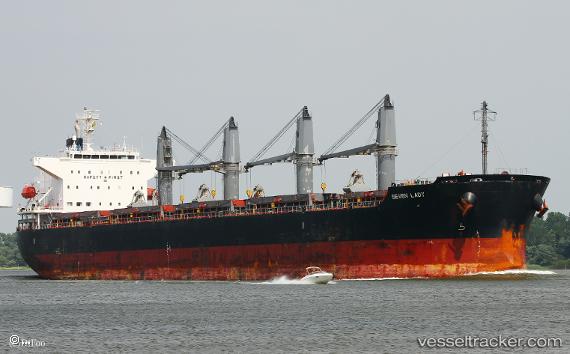
 TRUE FRIEND
Current Status
Where is the vessel?
TRUE FRIEND is currently in 14 nm S of Santaella, based on AIS data received about 14h ago.
Latest AIS update:
Current position: 37.33743° N, 4.88265° E (14 nm S of Santaella)
Average speed (last 7 days): Loading…
Average speed (last 30 days): Loading…
Vessel profile: TRUE FRIEND is a Bulk Carrier with dimensions m x m.
This page combines live AIS, route history, probable destination signals, nearby traffic, and port activity for practical vessel monitoring.
The current position of vessel TRUE FRIEND is 37.33743 lat / 4.88265 lng. Updated: 2026-05-21 01:44:58 UTCNearest reference points:
- Near Bejaia
- Near Carmona
- Near Zamoranos
Currently sailing under the flag of Barbados ![]()
Details:
Live Vessel TRUE FRIEND Analytics (details, animations, etc.)
Recent AIS points (UTC):
2026-05-20 23:03:49 UTC · 37.32038, 4.86480 · SOG 0.5 kn · COG 31°2026-05-20 23:26:09 UTC · 37.32295, 4.86728 · SOG 0.5 kn · COG 18°
2026-05-21 01:26:49 UTC · 37.33577, 4.88033 · SOG 0.4 kn · COG 11°
2026-05-21 01:44:58 UTC · 37.33743, 4.88265 · SOG 0 kn · COG 356°