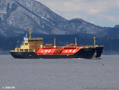
Akebono Maru
Current StatusWhere is the vessel?
Akebono Maru is currently in Near Hakodate, based on AIS data received about 14h ago.
Latest AIS update:
Current position: 41.78199° N, 140.72302° E (Near Hakodate)
Average speed (last 7 days): Loading…
Average speed (last 30 days): Loading…
Vessel profile: Akebono Maru is a Lng Tanker with dimensions 17m x 99m.
This page combines live AIS, route history, probable destination signals, nearby traffic, and port activity for practical vessel monitoring.
The current position of vessel Akebono Maru is 41.78199 lat / 140.72302 lng. Updated: 2026-05-20 16:08:14 UTCNearest reference points:
- Near Muroran
- 23 nm NE of SAI
- 11 nm NW of Yokohama, Aomori
Details:
Live Vessel Akebono Maru Analytics (details, animations, etc.)
Recent AIS points (UTC):
2026-05-20 13:11:13 UTC · 41.78194, 140.72308 · SOG 0 kn · COG 270°2026-05-20 14:02:12 UTC · 41.78193, 140.72305 · SOG 0 kn · COG 270°
2026-05-20 15:23:13 UTC · 41.78196, 140.72301 · SOG 0 kn · COG 270°
2026-05-20 16:08:14 UTC · 41.78199, 140.72302 · SOG 0 kn · COG 270°