 vesseltracker.com
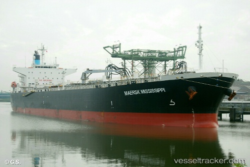
 MFM MISSISSIPPI
Current Status
Where is the vessel?
MFM MISSISSIPPI is currently in 20 nm SE of Richards Bay, based on AIS data received about 14h ago.
Latest AIS update:
Current position: 29.01919° S, 32.45202° E (20 nm SE of Richards Bay)
Average speed (last 7 days): Loading…
Average speed (last 30 days): Loading…
Vessel profile: MFM MISSISSIPPI is a Oil Products Tanker with dimensions m x m.
This page combines live AIS, route history, probable destination signals, nearby traffic, and port activity for practical vessel monitoring.
The current position of vessel MFM MISSISSIPPI is -29.01919 lat / 32.45202 lng. Updated: 2026-05-18 07:50:43 UTCNearest reference points:
- 42 nm E of Richards Bay
- Near Umhlanga Rocks
- Near Durban
Currently sailing under the flag of Marshall Islands ![]()
Details:
Live Vessel MFM MISSISSIPPI Analytics (details, animations, etc.)
Recent AIS points (UTC):
2026-05-18 04:13:24 UTC · -29.50029, 32.04037 · SOG 9.4 kn · COG 34°2026-05-18 05:56:15 UTC · -29.26816, 32.23919 · SOG 9.9 kn · COG 38°
2026-05-18 07:19:13 UTC · -29.08296, 32.39469 · SOG 9.6 kn · COG 40°
2026-05-18 07:50:43 UTC · -29.01919, 32.45202 · SOG 9 kn · COG 39°