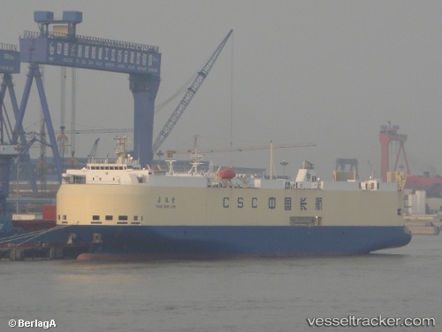
Chang Wang Long
Current StatusWhere is the vessel?
Chang Wang Long is currently in 113 nm W of Hongdo, based on AIS data received about 14h ago.
Latest AIS update:
Current position: 35.00987° N, 122.92848° E (113 nm W of Hongdo)
Average speed (last 7 days): Loading…
Average speed (last 30 days): Loading…
Vessel profile: Chang Wang Long is a Vehicles Carrier with dimensions 24m x 141m.
This page combines live AIS, route history, probable destination signals, nearby traffic, and port activity for practical vessel monitoring.
The current position of vessel Chang Wang Long is 35.00987 lat / 122.92848 lng. Updated: 2026-05-20 13:15:31 UTCNearest reference points:
- 116 nm NE of DAFENG
- 83 nm SE of Shidao Pt
- 111 nm W of Gageohyangri
Details:
Live Vessel Chang Wang Long Analytics (details, animations, etc.)
Recent AIS points (UTC):
2026-05-20 07:47:56 UTC · 33.81043, 122.94411 · SOG 13.7 kn · COG 357°2026-05-20 07:47:56 UTC · 33.81043, 122.94411 · SOG 13.7 kn · COG 357°
2026-05-20 10:55:02 UTC · 34.51159, 122.92329 · SOG 13 kn · COG 0°
2026-05-20 13:15:31 UTC · 35.00987, 122.92848 · SOG 12.5 kn · COG 358°