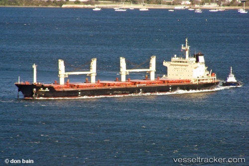
Sea Topaz
Current StatusWhere is the vessel?
Sea Topaz is currently in 95 nm SW of Port Blair, based on AIS data received about 15h ago.
Latest AIS update:
Current position: 10.40833° N, 91.79667° E (95 nm SW of Port Blair)
Average speed (last 7 days): Loading…
Average speed (last 30 days): Loading…
Vessel profile: Sea Topaz is a Bulk Carrier with dimensions 28m x 177m.
This page combines live AIS, route history, probable destination signals, nearby traffic, and port activity for practical vessel monitoring.
The current position of vessel Sea Topaz is 10.40833 lat / 91.79667 lng. Updated: 2026-05-19 04:06:20 UTCNearest reference points:
- Near Port Blair
- 120 nm W of Port Blair
- 124 nm S of Armenia
Details:
Live Vessel Sea Topaz Analytics (details, animations, etc.)
Recent AIS points (UTC):
2026-05-19 01:21:21 UTC · 10.73667, 91.43167 · SOG 10 kn · COG -1°2026-05-19 02:24:25 UTC · 10.61500, 91.57500 · SOG 10 kn · COG -1°
2026-05-19 04:06:20 UTC · 10.40833, 91.79667 · SOG 10 kn · COG -1°
2026-05-19 04:06:20 UTC · 10.40833, 91.79667 · SOG 10 kn · COG -1°