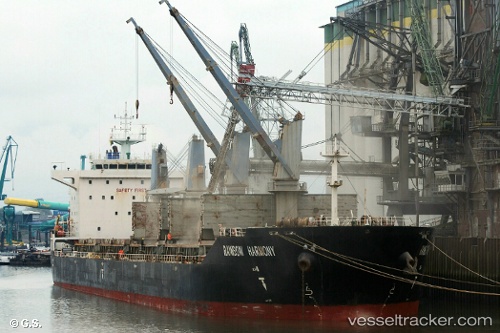
Rainbow Harmony
Current StatusWhere is the vessel?
Rainbow Harmony is currently in Near Choa Chu Kang, based on AIS data received about 14h ago.
Latest AIS update:
Current position: 1.24170° N, 103.90236° E (Near Choa Chu Kang)
Average speed (last 7 days): Loading…
Average speed (last 30 days): Loading…
Vessel profile: Rainbow Harmony is a Bulk Carrier with dimensions 28m x 180m.
This page combines live AIS, route history, probable destination signals, nearby traffic, and port activity for practical vessel monitoring.
The current position of vessel Rainbow Harmony is 1.24170 lat / 103.90236 lng. Updated: 2026-05-21 16:06:14 UTCNearest reference points:
- Near Choa Chu Kang
- Near Tampines
- Near Sambu
Details:
Live Vessel Rainbow Harmony Analytics (details, animations, etc.)
Recent AIS points (UTC):
2026-05-21 13:33:35 UTC · 1.27509, 104.06954 · SOG 4.1 kn · COG 252°2026-05-21 13:49:54 UTC · 1.27171, 104.05062 · SOG 4 kn · COG 250°
2026-05-21 16:06:04 UTC · 1.24150, 103.90244 · SOG 4.2 kn · COG 350°
2026-05-21 16:06:14 UTC · 1.24170, 103.90236 · SOG 4.2 kn · COG 350°