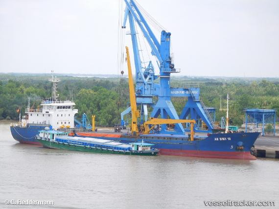
An Binh 18
Current StatusWhere is the vessel?
An Binh 18 is currently in 58 nm N of Dai Hung (STS Load), based on AIS data received about 1d ago.
Latest AIS update:
Current position: 9.76560° N, 102.93049° E (58 nm N of Dai Hung (STS Load))
Average speed (last 7 days): Loading…
Average speed (last 30 days): Loading…
Vessel profile: An Binh 18 is a General Cargo Ship with dimensions 13m x 90m.
This page combines live AIS, route history, probable destination signals, nearby traffic, and port activity for practical vessel monitoring.
The current position of vessel An Binh 18 is 9.76560 lat / 102.93049 lng. Updated: 2026-06-16 05:42:51 UTCNearest reference points:
- 63 nm NW of Dai Hung (STS Load)
- 46 nm W of Dai Hung (STS Load)
- Near KRONG PREAH SIHANOUK
Details:
Live Vessel An Binh 18 Analytics (details, animations, etc.)
Recent AIS points (UTC):
2026-06-16 05:42:51 UTC · 9.76560, 102.93049 · SOG 7.6 kn · COG 145°2026-06-16 05:42:51 UTC · 9.76560, 102.93049 · SOG 7.6 kn · COG 145°
2026-06-16 05:42:51 UTC · 9.76560, 102.93049 · SOG 7.6 kn · COG 145°
2026-06-16 05:42:51 UTC · 9.76560, 102.93049 · SOG 7.6 kn · COG 145°