 Hua Hai Long
Current Status
Where is the vessel?
Hua Hai Long is currently in Near Cape Saint Jacques, based on AIS data received about 15h ago.
Latest AIS update:
Current position: 10.35804° N, 107.03958° E (Near Cape Saint Jacques)
Average speed (last 7 days): Loading…
Average speed (last 30 days): Loading…
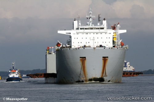
Vessel profile: Hua Hai Long is a Heavy Load Carrier with dimensions 182m x 44m.
This page combines live AIS, route history, probable destination signals, nearby traffic, and port activity for practical vessel monitoring.
The current position of vessel Hua Hai Long is 10.35804 lat / 107.03958 lng. Updated: 2026-06-10 02:01:12 UTCNearest reference points:
- Near Cape Saint Jacques
- Near Cai Mep
- Near Cape St. Jacques
Currently sailing under the flag of China ![]()
Hua Hai Long built in 2012 year
Deadweight:
30002 tDetails:
Live Vessel Hua Hai Long Analytics (details, animations, etc.)
Recent AIS points (UTC):
2026-06-09 23:04:14 UTC · 10.35794, 107.03926 · SOG 0 kn · COG 169°2026-06-10 00:04:24 UTC · 10.35802, 107.03903 · SOG 0 kn · COG 170°
2026-06-10 01:19:12 UTC · 10.35812, 107.03935 · SOG 0 kn · COG 180°
2026-06-10 02:01:12 UTC · 10.35804, 107.03958 · SOG 0 kn · COG 196°