 Ligulao
Current Status
Where is the vessel?
Ligulao is currently in 99 nm NW of PONTIANAK, based on AIS data received about 14h ago.
Latest AIS update:
Current position: 0.98833° N, 108.04333° E (99 nm NW of PONTIANAK)
Average speed (last 7 days): Loading…
Average speed (last 30 days): Loading…
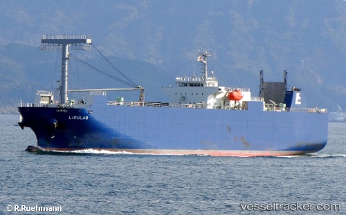
Vessel profile: Ligulao is a Vehicles Carrier with dimensions 119m x 20m.
This page combines live AIS, route history, probable destination signals, nearby traffic, and port activity for practical vessel monitoring.
The current position of vessel Ligulao is 0.98833 lat / 108.04333 lng. Updated: 2026-05-19 22:46:13 UTCNearest reference points:
- 12 nm SE of PONTIANAK
- 17 nm SW of Sanggau
- 45 nm E of Terempa
Currently sailing under the flag of Panama ![]()
Ligulao built in 2010 year
Deadweight:
5296 tDetails:
Live Vessel Ligulao Analytics (details, animations, etc.)
Recent AIS points (UTC):
2026-05-19 19:13:10 UTC · 1.62167, 108.14667 · SOG 10 kn · COG -1°2026-05-19 20:16:10 UTC · 1.43833, 108.11833 · SOG 10 kn · COG -1°
2026-05-19 21:16:10 UTC · 1.26500, 108.08833 · SOG 10 kn · COG -1°
2026-05-19 22:46:13 UTC · 0.98833, 108.04333 · SOG 11 kn · COG -1°