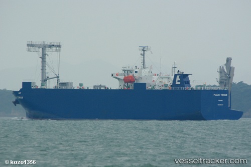
Pulau Tioman
Current StatusWhere is the vessel?
Pulau Tioman is currently in 28 nm SE of Pulau Jarak, based on AIS data received about 15h ago.
Latest AIS update:
Current position: 3.55005° N, 100.27636° E (28 nm SE of Pulau Jarak)
Average speed (last 7 days): Loading…
Average speed (last 30 days): Loading…
Vessel profile: Pulau Tioman is a Vehicles Carrier with dimensions 20m x 120m.
This page combines live AIS, route history, probable destination signals, nearby traffic, and port activity for practical vessel monitoring.
The current position of vessel Pulau Tioman is 3.55005 lat / 100.27636 lng. Updated: 2026-05-22 04:16:54 UTCNearest reference points:
- 11 nm W of Pangkur
- Near PANGKOR
- Near Simpang Lima
Details:
Live Vessel Pulau Tioman Analytics (details, animations, etc.)
Recent AIS points (UTC):
2026-05-22 01:25:20 UTC · 3.93094, 99.94265 · SOG 10.7 kn · COG -1°2026-05-22 02:27:56 UTC · 3.79167, 100.07000 · SOG 10 kn · COG -1°
2026-05-22 04:13:53 UTC · 3.55711, 100.27073 · SOG 10.6 kn · COG -1°
2026-05-22 04:16:54 UTC · 3.55005, 100.27636 · SOG 10.6 kn · COG -1°