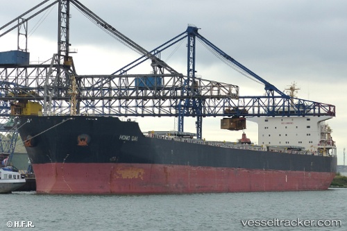
Hong Dai
Current StatusWhere is the vessel?
Hong Dai is currently in 197 nm W of La Restinga, based on AIS data received about 14h ago.
Latest AIS update:
Current position: 26.39600° N, 21.40873° W (197 nm W of La Restinga)
Average speed (last 7 days): Loading…
Average speed (last 30 days): Loading…
Vessel profile: Hong Dai is a Bulk Carrier with dimensions 32m x 225m.
This page combines live AIS, route history, probable destination signals, nearby traffic, and port activity for practical vessel monitoring.
The current position of vessel Hong Dai is 26.39600 lat / -21.40873 lng. Updated: 2026-05-20 15:37:51 UTCNearest reference points:
- 119 nm W of Frontera
- 100 nm W of Tijarafe
Details:
Live Vessel Hong Dai Analytics (details, animations, etc.)
Recent AIS points (UTC):
2026-05-20 12:13:34 UTC · 26.98893, -20.93360 · SOG 12.9 kn · COG 212°2026-05-20 13:14:02 UTC · 26.80698, -21.07147 · SOG 13 kn · COG 212°
2026-05-20 14:19:14 UTC · 26.61442, -21.22032 · SOG 12.7 kn · COG 217°
2026-05-20 15:37:51 UTC · 26.39600, -21.40873 · SOG 12.8 kn · COG 217°