 vesseltracker.com
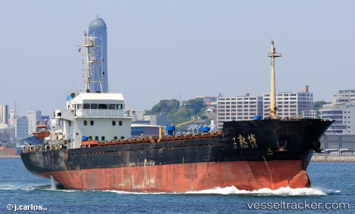
 Bo Dun 2
Current Status
Where is the vessel?
Bo Dun 2 is currently in Near Sigri Lesvou, based on AIS data received less than 1h ago.
Latest AIS update:
Current position: 39.26150° N, 25.64234° E (Near Sigri Lesvou)
Average speed (last 7 days): Loading…
Average speed (last 30 days): Loading…
Vessel profile: Bo Dun 2 is a General Cargo Ship with dimensions 81m x 14m.
This page combines live AIS, route history, probable destination signals, nearby traffic, and port activity for practical vessel monitoring.
The current position of vessel Bo Dun 2 is 39.26150 lat / 25.64234 lng. Updated: 2026-05-13 21:34:01 UTCNearest reference points:
- 16 nm NW of Sigri Lesvou
- 14 nm NW of Baba Point
- 29 nm SW of Sigri Lesvou
Currently sailing under the flag of Panama ![]()
Details:
Live Vessel Bo Dun 2 Analytics (details, animations, etc.)
Recent AIS points (UTC):
2026-05-13 18:17:11 UTC · 39.72524, 25.77949 · SOG 8.5 kn · COG 202°2026-05-13 19:16:31 UTC · 39.58695, 25.73559 · SOG 8.5 kn · COG 199°
2026-05-13 20:16:01 UTC · 39.44492, 25.69598 · SOG 8.8 kn · COG 195°
2026-05-13 21:34:01 UTC · 39.26150, 25.64234 · SOG 8.6 kn · COG 199°