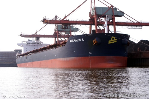
Michalis L
Current StatusWhere is the vessel?
Michalis L is currently in Near CAM PHA, based on AIS data received about 14h ago.
Latest AIS update:
Current position: 20.88615° N, 107.27382° E (Near CAM PHA)
Average speed (last 7 days): Loading…
Average speed (last 30 days): Loading…
Vessel profile: Michalis L is a Bulk Carrier with dimensions 37m x 230m.
This page combines live AIS, route history, probable destination signals, nearby traffic, and port activity for practical vessel monitoring.
The current position of vessel Michalis L is 20.88615 lat / 107.27382 lng. Updated: 2026-07-07 09:31:31 UTCNearest reference points:
- 18 nm SE of Ha Long
- 14 nm SE of Nam Hai Dinh Vu Port
- 12 nm SE of Nam Hai Dinh Vu Port
Details:
Live Vessel Michalis L Analytics (details, animations, etc.)
Recent AIS points (UTC):
2026-07-07 06:25:30 UTC · 20.88635, 107.27437 · SOG 0 kn · COG 175°2026-07-07 08:01:30 UTC · 20.88618, 107.27418 · SOG 0.1 kn · COG 172°
2026-07-07 08:31:30 UTC · 20.88610, 107.27395 · SOG 0 kn · COG 160°
2026-07-07 09:31:31 UTC · 20.88615, 107.27382 · SOG 0 kn · COG 157°