 vesseltracker.com
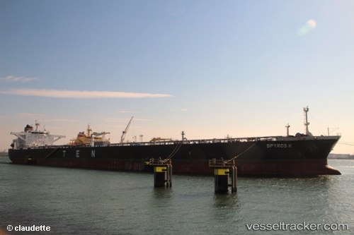
 Spyros K
Current Status
Where is the vessel?
Spyros K is currently in 26 nm SE of Sabine Pass, based on AIS data received less than 1h ago.
Latest AIS update:
Current position: 29.33344° N, 93.65958° W (26 nm SE of Sabine Pass)
Average speed (last 7 days): Loading…
Average speed (last 30 days): Loading…
Vessel profile: Spyros K is a Crude Oil Tanker with dimensions 274m x 48m.
This page combines live AIS, route history, probable destination signals, nearby traffic, and port activity for practical vessel monitoring.
The current position of vessel Spyros K is 29.33344 lat / -93.65958 lng. Updated: 2026-04-06 10:19:56 UTCNearest reference points:
- 23 nm SW of Sabine Pass
- Near SABINE PASS
- 45 nm SE of Galveston
Currently sailing under the flag of Liberia ![]()
Spyros K built in 2011 year
Deadweight:
157648 tDetails:
Live Vessel Spyros K Analytics (details, animations, etc.)
Recent AIS points (UTC):
2026-04-06 03:40:27 UTC · 29.19884, -93.75229 · SOG 2.2 kn · COG 312°2026-04-06 06:08:38 UTC · 29.20154, -93.74455 · SOG 2.2 kn · COG 320°
2026-04-06 08:09:47 UTC · 29.19697, -93.71571 · SOG 2.1 kn · COG 333°
2026-04-06 10:19:56 UTC · 29.33344, -93.65958 · SOG 8.2 kn · COG 357°