 MIKE THOMAS
Current Status
Where is the vessel?
MIKE THOMAS is currently in Near Naka-Ku, Kanagawa, based on AIS data received about 14h ago.
Latest AIS update:
Current position: 35.39793° N, 139.62379° E (Near Naka-Ku, Kanagawa)
Average speed (last 7 days): Loading…
Average speed (last 30 days): Loading…
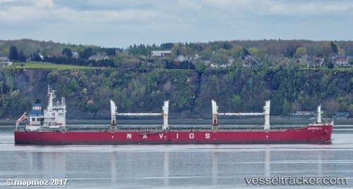
Vessel profile: MIKE THOMAS is a Bulk Carrier with dimensions m x m.
This page combines live AIS, route history, probable destination signals, nearby traffic, and port activity for practical vessel monitoring.
The current position of vessel MIKE THOMAS is 35.39793 lat / 139.62379 lng. Updated: 2026-06-17 13:54:56 UTCNearest reference points:
- Near Naka-Ku, Kanagawa
- Near Yokohama
- Near Kawasaki
Currently sailing under the flag of Portugal ![]()
Details:
Live Vessel MIKE THOMAS Analytics (details, animations, etc.)
Recent AIS points (UTC):
2026-06-17 10:30:53 UTC · 35.39795, 139.62386 · SOG 0 kn · COG 210°2026-06-17 11:54:55 UTC · 35.39799, 139.62376 · SOG 0 kn · COG 210°
2026-06-17 13:30:57 UTC · 35.39792, 139.62381 · SOG 0 kn · COG 210°
2026-06-17 13:54:56 UTC · 35.39793, 139.62379 · SOG 0 kn · COG 210°