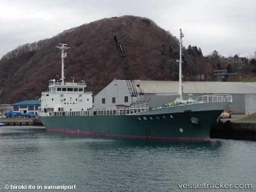
Taiyo Maru No.18
Current StatusWhere is the vessel?
Taiyo Maru No.18 is currently in 11 nm E of TOKUSHIMA, based on AIS data received about 14h ago.
Latest AIS update:
Current position: 34.08919° N, 134.81102° E (11 nm E of TOKUSHIMA)
Average speed (last 7 days): Loading…
Average speed (last 30 days): Loading…
Vessel profile: Taiyo Maru No.18 is a General Cargo Ship with dimensions 11m x 62m.
This page combines live AIS, route history, probable destination signals, nearby traffic, and port activity for practical vessel monitoring.
The current position of vessel Taiyo Maru No.18 is 34.08919 lat / 134.81102 lng. Updated: 2026-05-20 01:45:22 UTCNearest reference points:
- Near TOKUSHIMA
- Near SHIMOTSU
- Near Awaji
Details:
Live Vessel Taiyo Maru No.18 Analytics (details, animations, etc.)
Recent AIS points (UTC):
2026-05-19 22:23:01 UTC · 33.61763, 135.31236 · SOG 11.9 kn · COG 318°2026-05-20 00:17:22 UTC · 33.88666, 135.01109 · SOG 10.9 kn · COG 319°
2026-05-20 01:20:21 UTC · 34.03392, 134.86868 · SOG 10.6 kn · COG 319°
2026-05-20 01:45:22 UTC · 34.08919, 134.81102 · SOG 10.4 kn · COG 319°