 vesseltracker.com
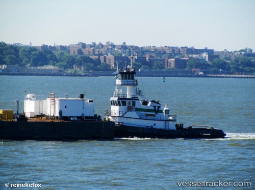
 Hunting Creek
Current Status
Where is the vessel?
Hunting Creek is currently in Near Port Richmond, based on AIS data received about 15h ago.
Latest AIS update:
Current position: 39.98017° N, 75.06816° W (Near Port Richmond)
Average speed (last 7 days): Loading…
Average speed (last 30 days): Loading…
Vessel profile: Hunting Creek is a Pusher Tug with dimensions 31m x 10m.
This page combines live AIS, route history, probable destination signals, nearby traffic, and port activity for practical vessel monitoring.
The current position of vessel Hunting Creek is 39.98017 lat / -75.06816 lng. Updated: 2026-05-18 08:19:28 UTCNearest reference points:
- Near Brooklawn
- Near Trainer
- Near Wilmington
Currently sailing under the flag of USA ![]()
Details:
Live Vessel Hunting Creek Analytics (details, animations, etc.)
Recent AIS points (UTC):
2026-05-18 04:39:07 UTC · 39.92967, -75.13585 · SOG 0 kn · COG 176°2026-05-18 06:05:37 UTC · 39.98015, -75.06829 · SOG 0.6 kn · COG 39°
2026-05-18 07:02:37 UTC · 39.98016, -75.06818 · SOG 0 kn · COG 40°
2026-05-18 08:19:28 UTC · 39.98017, -75.06816 · SOG 0 kn · COG 40°