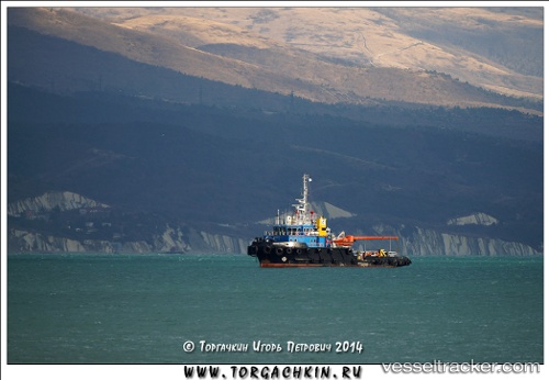
 LAMNALCO CHAIKA
Current Status
Where is the vessel?
LAMNALCO CHAIKA is currently in 20 nm W of Kiamari, based on AIS data received about 14h ago.
Latest AIS update:
Current position: 24.91078° N, 66.61874° E (20 nm W of Kiamari)
Average speed (last 7 days): Loading…
Average speed (last 30 days): Loading…
Vessel profile: LAMNALCO CHAIKA is a Tug with dimensions m x m.
This page combines live AIS, route history, probable destination signals, nearby traffic, and port activity for practical vessel monitoring.
The current position of vessel LAMNALCO CHAIKA is 24.91078 lat / 66.61874 lng. Updated: 2026-06-15 04:15:27 UTCNearest reference points:
- Near Kiamari
- 16 nm S of Kiamari
- Near PORT QASIM
Currently sailing under the flag of Pakistan ![]()
Details:
Live Vessel LAMNALCO CHAIKA Analytics (details, animations, etc.)
Recent AIS points (UTC):
2026-06-15 01:19:56 UTC · 24.91081, 66.61877 · SOG 0.6 kn · COG -1°2026-06-15 02:05:14 UTC · 24.91085, 66.61876 · SOG 0.2 kn · COG -1°
2026-06-15 03:23:59 UTC · 24.91067, 66.61873 · SOG 0.1 kn · COG -1°
2026-06-15 04:15:27 UTC · 24.91078, 66.61874 · SOG 0.1 kn · COG -1°