 vesseltracker.com
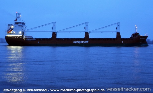
 Maasgracht
Current Status
Where is the vessel?
Maasgracht is currently in Near PENGERANG, based on AIS data received less than 1h ago.
Latest AIS update:
Current position: 1.27897° N, 104.14278° E (Near PENGERANG)
Average speed (last 7 days): Loading…
Average speed (last 30 days): Loading…
Vessel profile: Maasgracht is a General Cargo Ship with dimensions 142m x 19m.
This page combines live AIS, route history, probable destination signals, nearby traffic, and port activity for practical vessel monitoring.
The current position of vessel Maasgracht is 1.27897 lat / 104.14278 lng. Updated: 2026-05-02 17:53:45 UTCNearest reference points:
- Near PENGERANG
- Near TANAH MERAH
- Near BATU AMPAR
Currently sailing under the flag of Netherlands ![]()
Maasgracht built in 2011 year
Deadweight:
11759 tDetails:
Live Vessel Maasgracht Analytics (details, animations, etc.)
Recent AIS points (UTC):
2026-05-02 13:49:12 UTC · 1.29625, 104.35027 · SOG 12.7 kn · COG 50°2026-05-02 15:54:24 UTC · 1.38976, 104.42409 · SOG 14.2 kn · COG 232°
2026-05-02 16:33:15 UTC · 1.31745, 104.31999 · SOG 8.6 kn · COG 245°
2026-05-02 17:53:45 UTC · 1.27897, 104.14278 · SOG 8 kn · COG 264°