 vesseltracker.com
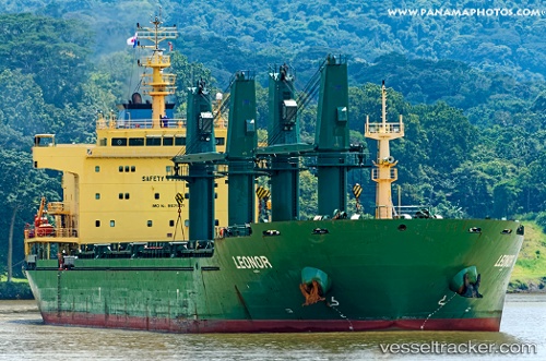
Leonor
Current StatusWhere is the vessel?
Leonor is currently in Near Rieme, based on AIS data received about 1h ago.
Latest AIS update:
Current position: 51.16085° N, 3.77670° E (Near Rieme)
Average speed (last 7 days): Loading…
Average speed (last 30 days): Loading…
Vessel profile: Leonor is a Bulk Carrier with dimensions 28m x 180m.
This page combines live AIS, route history, probable destination signals, nearby traffic, and port activity for practical vessel monitoring.
The current position of vessel Leonor is 51.16085 lat / 3.77670 lng. Updated: 2026-05-16 05:26:07 UTCNearest reference points:
- Near Rieme
- Near Oostakker
- Near SLUISKIL
Details:
Live Vessel Leonor Analytics (details, animations, etc.)
Recent AIS points (UTC):
2026-05-16 01:50:08 UTC · 51.16084, 3.77668 · SOG 0 kn · COG 257°2026-05-16 03:22:21 UTC · 51.16086, 3.77668 · SOG 0 kn · COG 257°
2026-05-16 04:02:11 UTC · 51.16086, 3.77668 · SOG 0 kn · COG 257°
2026-05-16 05:26:07 UTC · 51.16085, 3.77670 · SOG 0 kn · COG 257°