 vesseltracker.com
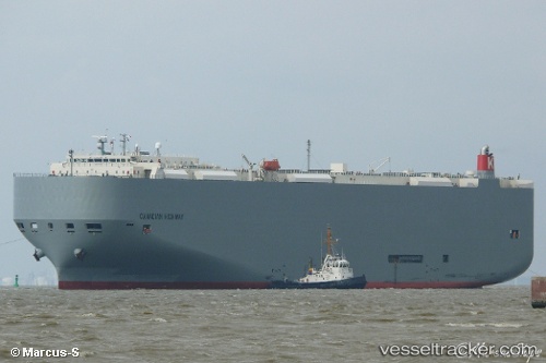
 Canadian Highway
Current Status
Where is the vessel?
Canadian Highway is currently in 98 nm W of Nayarit, based on AIS data received less than 1h ago.
Latest AIS update:
Current position: 21.09195° N, 108.17095° W (98 nm W of Nayarit)
Average speed (last 7 days): Loading…
Average speed (last 30 days): Loading…
Vessel profile: Canadian Highway is a Vehicles Carrier with dimensions 199m x 32m.
This page combines live AIS, route history, probable destination signals, nearby traffic, and port activity for practical vessel monitoring.
The current position of vessel Canadian Highway is 21.09195 lat / -108.17095 lng. Updated: 2026-05-15 10:50:58 UTCNearest reference points:
- 35 nm S of Nayarit
- 67 nm S of Los Cabos
- Near San Jose del Cabo
Currently sailing under the flag of Panama ![]()
Canadian Highway built in 2010 year
Deadweight:
18581 tDetails:
Live Vessel Canadian Highway Analytics (details, animations, etc.)
Recent AIS points (UTC):
2026-05-15 07:13:37 UTC · 20.64803, -107.49669 · SOG 12.6 kn · COG 308°2026-05-15 07:47:47 UTC · 20.71935, -107.60228 · SOG 12.7 kn · COG 308°
2026-05-15 10:06:37 UTC · 21.00116, -108.02983 · SOG 12.9 kn · COG 305°
2026-05-15 10:50:58 UTC · 21.09195, -108.17095 · SOG 13.1 kn · COG 307°