 ASALET
Current Status
Where is the vessel?
ASALET is currently in 308 nm NE of Saint George, based on AIS data received about 14h ago.
Latest AIS update:
Current position: 34.45399° N, 59.05503° W (308 nm NE of Saint George)
Average speed (last 7 days): Loading…
Average speed (last 30 days): Loading…
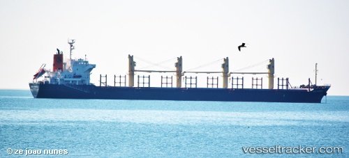
Vessel profile: ASALET is a Bulk Carrier with dimensions m x m.
This page combines live AIS, route history, probable destination signals, nearby traffic, and port activity for practical vessel monitoring.
The current position of vessel ASALET is 34.45399 lat / -59.05503 lng. Updated: 2026-05-20 19:30:44 UTCNearest reference points:
- 311 nm E of Saint George
- Open sea, approx. 401 nm off the nearest listed port
- Open sea, approx. 403 nm off the nearest listed port
Currently sailing under the flag of Liberia ![]()
Details:
Live Vessel ASALET Analytics (details, animations, etc.)
Recent AIS points (UTC):
2026-05-20 15:47:03 UTC · 34.35833, -59.88333 · SOG 11 kn · COG -1°2026-05-20 16:26:02 UTC · 34.36833, -59.74167 · SOG 10 kn · COG -1°
2026-05-20 17:29:02 UTC · 34.39167, -59.51167 · SOG 11 kn · COG -1°
2026-05-20 19:30:44 UTC · 34.45399, -59.05503 · SOG 10.9 kn · COG 68°