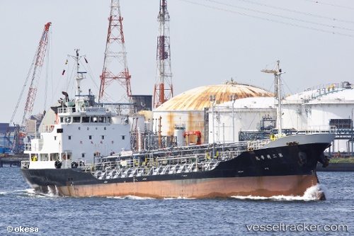
 Eikamaru No.2
Current Status
Where is the vessel?
Eikamaru No.2 is currently in Near CHIBA, based on AIS data received about 14h ago.
Latest AIS update:
Current position: 35.57835° N, 140.06815° E (Near CHIBA)
Average speed (last 7 days): Loading…
Average speed (last 30 days): Loading…
Vessel profile: Eikamaru No.2 is a Chemical Tanker with dimensions 60m x 10m.
This page combines live AIS, route history, probable destination signals, nearby traffic, and port activity for practical vessel monitoring.
The current position of vessel Eikamaru No.2 is 35.57835 lat / 140.06815 lng. Updated: 2026-05-21 01:32:08 UTCNearest reference points:
- Near ANEGASAKI
- Near Aomi
- Near Kawasaki
Currently sailing under the flag of Japan ![]()
Details:
Live Vessel Eikamaru No.2 Analytics (details, animations, etc.)
Recent AIS points (UTC):
2026-05-20 22:05:46 UTC · 35.57791, 140.06625 · SOG 1 kn · COG 118°2026-05-20 23:46:27 UTC · 35.57837, 140.06735 · SOG 0 kn · COG 193°
2026-05-21 01:18:37 UTC · 35.57841, 140.06802 · SOG 0 kn · COG 204°
2026-05-21 01:32:08 UTC · 35.57835, 140.06815 · SOG 0.2 kn · COG 224°