 ADRE
ADRE
Current Status
Where is the vessel?
ADRE is currently in 83 nm E of Gan, based on AIS data received about 14h ago.
Latest AIS update:
Current position: 1.09339° S, 74.47333° E (83 nm E of Gan)
Average speed (last 7 days): Loading…
Average speed (last 30 days): Loading…
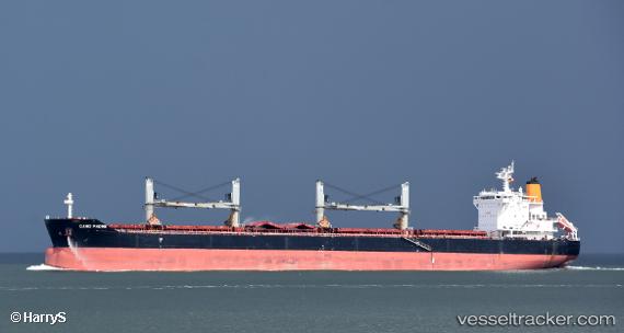
Vessel profile: ADRE is a Bulk Carrier with dimensions m x m.
This page combines live AIS, route history, probable destination signals, nearby traffic, and port activity for practical vessel monitoring.
The current position of vessel ADRE is -1.09339 lat / 74.47333 lng. Updated: 2026-06-10 15:59:31 UTCNearest reference points:
- 146 nm E of Koodoo Fisheries
Currently sailing under the flag of Liberia ![]()
Details:
Live Vessel ADRE Analytics (details, animations, etc.)
Recent AIS points (UTC):
2026-06-10 13:25:26 UTC · -1.43628, 74.14284 · SOG 11.2 kn · COG 42°2026-06-10 13:25:26 UTC · -1.43628, 74.14284 · SOG 11.2 kn · COG 42°
2026-06-10 15:59:31 UTC · -1.09339, 74.47333 · SOG 11 kn · COG 44°
2026-06-10 15:59:31 UTC · -1.09339, 74.47333 · SOG 11 kn · COG 44°