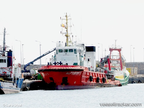
Dong Fang Kan Tan 3
Current StatusWhere is the vessel?
Dong Fang Kan Tan 3 is currently in Near Esnnad, based on AIS data received about 15h ago.
Latest AIS update:
Current position: 24.31418° N, 54.48499° E (Near Esnnad)
Average speed (last 7 days): Loading…
Average speed (last 30 days): Loading…
Vessel profile: Dong Fang Kan Tan 3 is a Tug with dimensions 12m x 62m.
This page combines live AIS, route history, probable destination signals, nearby traffic, and port activity for practical vessel monitoring.
The current position of vessel Dong Fang Kan Tan 3 is 24.31418 lat / 54.48499 lng. Updated: 2026-05-19 10:57:08 UTCNearest reference points:
- Near Esnnad
- Near KHALIFA
- Near Jebel Ali Free Zone
Details:
Live Vessel Dong Fang Kan Tan 3 Analytics (details, animations, etc.)
Recent AIS points (UTC):
2026-05-19 07:39:50 UTC · 24.31414, 54.48486 · SOG 0 kn · COG 176°2026-05-19 09:17:58 UTC · 24.31416, 54.48493 · SOG 0.1 kn · COG 175°
2026-05-19 10:13:28 UTC · 24.31417, 54.48486 · SOG 0.2 kn · COG 176°
2026-05-19 10:57:08 UTC · 24.31418, 54.48499 · SOG 0 kn · COG -1°