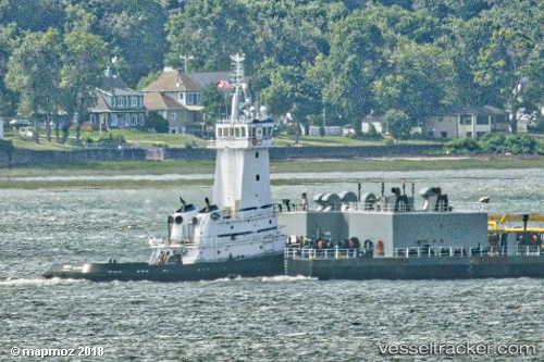
 Mako
Mako
Current Status
Where is the vessel?
Mako is currently in Near Galveston, based on AIS data received about 11d ago.
Latest AIS update:
Current position: 29.31333° N, 94.79500° W (Near Galveston)
Average speed (last 7 days): Loading…
Average speed (last 30 days): Loading…
Vessel profile: Mako is a Pusher Tug with dimensions 142m x 12m.
This page combines live AIS, route history, probable destination signals, nearby traffic, and port activity for practical vessel monitoring.
The current position of vessel Mako is 29.31333 lat / -94.79500 lng. Updated: 2026-05-14 12:23:07 UTCNearest reference points:
- Near Port Bolivar
- Near Texas City
- 12 nm SE of Port Bolivar
Currently sailing under the flag of USA ![]()
Mako built in 2011 year
Deadweight:
419 tDetails:
Live Vessel Mako Analytics (details, animations, etc.)
Recent AIS points (UTC):
2026-05-14 12:23:07 UTC · 29.31333, -94.79500 · SOG 0 kn · COG -1°2026-05-14 12:23:07 UTC · 29.31333, -94.79500 · SOG 0 kn · COG -1°
2026-05-14 12:23:07 UTC · 29.31333, -94.79500 · SOG 0 kn · COG -1°
2026-05-14 12:23:07 UTC · 29.31333, -94.79500 · SOG 0 kn · COG -1°