 AEOLIAN
Current Status
Where is the vessel?
AEOLIAN is currently in Near Boyne Island, based on AIS data received about 14h ago.
Latest AIS update:
Current position: 23.83462° S, 151.46024° E (Near Boyne Island)
Average speed (last 7 days): Loading…
Average speed (last 30 days): Loading…
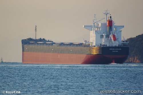
Vessel profile: AEOLIAN is a Bulk Carrier with dimensions 229m x 32m.
This page combines live AIS, route history, probable destination signals, nearby traffic, and port activity for practical vessel monitoring.
The current position of vessel AEOLIAN is -23.83462 lat / 151.46024 lng. Updated: 2026-05-19 03:43:18 UTCNearest reference points:
- Near Boyne Island
- Near Gladstone Harbor
- Near ROSSLYN
Currently sailing under the flag of Liberia ![]()
AEOLIAN built in 2012 year
Deadweight:
83478 tDetails:
Live Vessel AEOLIAN Analytics (details, animations, etc.)
Recent AIS points (UTC):
2026-05-18 23:55:19 UTC · -23.83243, 151.45740 · SOG 0 kn · COG 94°2026-05-19 02:04:19 UTC · -23.83382, 151.45808 · SOG 0.2 kn · COG 49°
2026-05-19 02:13:18 UTC · -23.83406, 151.45834 · SOG 0.2 kn · COG 43°
2026-05-19 03:43:18 UTC · -23.83462, 151.46024 · SOG 0.1 kn · COG 344°