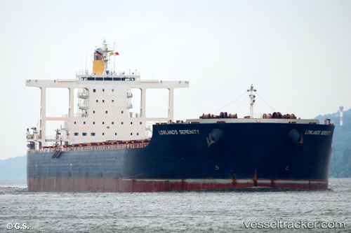
Lowlands Serenity
Current StatusWhere is the vessel?
Lowlands Serenity is currently in 378 nm SW of Diego Garcia, based on AIS data received about 14h ago.
Latest AIS update:
Current position: 10.00418° S, 66.71677° E (378 nm SW of Diego Garcia)
Average speed (last 7 days): Loading…
Average speed (last 30 days): Loading…
Vessel profile: Lowlands Serenity is a Bulk Carrier with dimensions 45m x 292m.
This page combines live AIS, route history, probable destination signals, nearby traffic, and port activity for practical vessel monitoring.
The current position of vessel Lowlands Serenity is -10.00418 lat / 66.71677 lng. Updated: 2026-05-25 23:36:07 UTCNearest reference points:
- Open sea, approx. 400 nm off the nearest listed port
- Open sea, approx. 401 nm off the nearest listed port
- Open sea, approx. 402 nm off the nearest listed port
Details:
Live Vessel Lowlands Serenity Analytics (details, animations, etc.)
Recent AIS points (UTC):
2026-05-25 19:29:31 UTC · -9.39753, 67.29538 · SOG 12.1 kn · COG 218°2026-05-25 21:23:18 UTC · -9.67655, 67.02888 · SOG 12.2 kn · COG 220°
2026-05-25 22:36:24 UTC · -9.85754, 66.85590 · SOG 12.4 kn · COG 217°
2026-05-25 23:36:07 UTC · -10.00418, 66.71677 · SOG 11.8 kn · COG 217°