 MONT FORT
Current Status
Where is the vessel?
MONT FORT is currently in Near Albatross Bay, based on AIS data received about 14h ago.
Latest AIS update:
Current position: 12.78667° S, 141.56833° E (Near Albatross Bay)
Average speed (last 7 days): Loading…
Average speed (last 30 days): Loading…
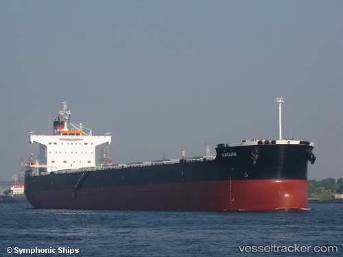
Vessel profile: MONT FORT is a Bulk Carrier with dimensions 227m x 32m.
This page combines live AIS, route history, probable destination signals, nearby traffic, and port activity for practical vessel monitoring.
The current position of vessel MONT FORT is -12.78667 lat / 141.56833 lng. Updated: 2026-05-20 22:04:13 UTCNearest reference points:
- Near Torres Strait
- Near Thursday Island
Currently sailing under the flag of Marshall Islands ![]()
MONT FORT built in 2012 year
Deadweight:
82113 tDetails:
Live Vessel MONT FORT Analytics (details, animations, etc.)
Recent AIS points (UTC):
2026-05-20 16:08:17 UTC · -12.59126, 141.18901 · SOG 12.5 kn · COG 128°2026-05-20 17:55:11 UTC · -12.76893, 141.45119 · SOG 10.3 kn · COG 104°
2026-05-20 21:46:14 UTC · -12.78667, 141.56833 · SOG 0 kn · COG -1°
2026-05-20 22:04:13 UTC · -12.78667, 141.56833 · SOG 0 kn · COG -1°