 vesseltracker.com
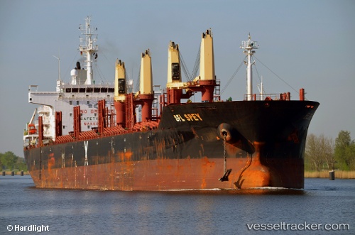
 CLIPPER SPEY
Current Status
Where is the vessel?
CLIPPER SPEY is currently in 158 nm N of Colomadu, based on AIS data received about 1h ago.
Latest AIS update:
Current position: 10.01428° N, 111.62195° E (158 nm N of Colomadu)
Average speed (last 7 days): Loading…
Average speed (last 30 days): Loading…
Vessel profile: CLIPPER SPEY is a Bulk Carrier with dimensions 30m x 181m.
This page combines live AIS, route history, probable destination signals, nearby traffic, and port activity for practical vessel monitoring.
The current position of vessel CLIPPER SPEY is 10.01428 lat / 111.62195 lng. Updated: 2026-05-15 16:52:42 UTCNearest reference points:
- 156 nm SE of Phan Rang-Tháp Chàm
- 163 nm E of Vinh Cam Ranh
- 142 nm N of Pulau Lang Lang
Currently sailing under the flag of Marshall Islands ![]()
CLIPPER SPEY built in 2011 year
Deadweight:
33985 tDetails:
Live Vessel CLIPPER SPEY Analytics (details, animations, etc.)
Recent AIS points (UTC):
2026-05-15 13:55:33 UTC · 10.46759, 111.77941 · SOG 9 kn · COG 200°2026-05-15 15:48:23 UTC · 10.18179, 111.67766 · SOG 9 kn · COG 196°
2026-05-15 16:39:42 UTC · 10.04812, 111.63322 · SOG 10 kn · COG 195°
2026-05-15 16:52:42 UTC · 10.01428, 111.62195 · SOG 9 kn · COG 195°