 vesseltracker.com
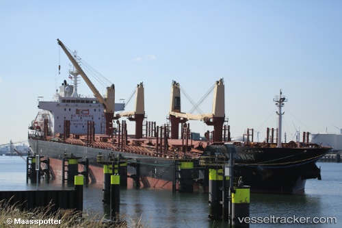
 CLIPPER MEDWAY
Current Status
Where is the vessel?
CLIPPER MEDWAY is currently in Near Caloocan City, based on AIS data received about 14h ago.
Latest AIS update:
Current position: 14.63442° N, 120.94779° E (Near Caloocan City)
Average speed (last 7 days): Loading…
Average speed (last 30 days): Loading…
Vessel profile: CLIPPER MEDWAY is a Bulk Carrier with dimensions 181m x 30m.
This page combines live AIS, route history, probable destination signals, nearby traffic, and port activity for practical vessel monitoring.
The current position of vessel CLIPPER MEDWAY is 14.63442 lat / 120.94779 lng. Updated: 2026-05-17 23:42:10 UTCNearest reference points:
- Near Caloocan City
- Near Malabon
- Near Tondo
Currently sailing under the flag of Marshall Islands ![]()
CLIPPER MEDWAY built in 2011 year
Deadweight:
33800 tDetails:
Live Vessel CLIPPER MEDWAY Analytics (details, animations, etc.)
Recent AIS points (UTC):
2026-05-17 20:15:10 UTC · 14.63433, 120.94776 · SOG 0.1 kn · COG 91°2026-05-17 21:30:11 UTC · 14.63437, 120.94768 · SOG 0 kn · COG 91°
2026-05-17 23:03:12 UTC · 14.63438, 120.94770 · SOG 0.1 kn · COG 91°
2026-05-17 23:42:10 UTC · 14.63442, 120.94779 · SOG 0 kn · COG 91°