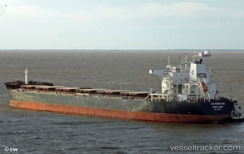
Anthemis
Current StatusWhere is the vessel?
Anthemis is currently in Near Tianjin Pt, based on AIS data received about 14h ago.
Latest AIS update:
Current position: 38.96713° N, 117.78903° E (Near Tianjin Pt)
Average speed (last 7 days): Loading…
Average speed (last 30 days): Loading…
Vessel profile: Anthemis is a Bulk Carrier with dimensions 38m x 229m.
This page combines live AIS, route history, probable destination signals, nearby traffic, and port activity for practical vessel monitoring.
The current position of vessel Anthemis is 38.96713 lat / 117.78903 lng. Updated: 2026-05-22 04:19:35 UTCNearest reference points:
- Near Tianjin Pt
- Near Tianjin Xingang Pt
- Near Dagu
Details:
Live Vessel Anthemis Analytics (details, animations, etc.)
Recent AIS points (UTC):
2026-05-22 01:16:35 UTC · 38.96713, 117.78905 · SOG 0 kn · COG 285°2026-05-22 02:28:33 UTC · 38.96713, 117.78905 · SOG 0 kn · COG 285°
2026-05-22 04:16:37 UTC · 38.96714, 117.78905 · SOG 0 kn · COG 286°
2026-05-22 04:19:35 UTC · 38.96713, 117.78903 · SOG 0 kn · COG 286°