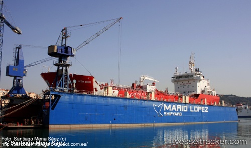
 IVER BEST
Current Status
Where is the vessel?
IVER BEST is currently in 11 nm W of Esposende, based on AIS data received about 15h ago.
Latest AIS update:
Current position: 41.46454° N, 9.02342° W (11 nm W of Esposende)
Average speed (last 7 days): Loading…
Average speed (last 30 days): Loading…
Vessel profile: IVER BEST is a Asphalt/Bitumen Tanker with dimensions m x m.
This page combines live AIS, route history, probable destination signals, nearby traffic, and port activity for practical vessel monitoring.
The current position of vessel IVER BEST is 41.46454 lat / -9.02342 lng. Updated: 2026-05-20 01:56:02 UTCNearest reference points:
- Near POVOA DE VARZIM
- Near Matosinhos
- Near Corujo
Currently sailing under the flag of Portugal ![]()
Details:
Live Vessel IVER BEST Analytics (details, animations, etc.)
Recent AIS points (UTC):
2026-05-19 23:05:23 UTC · 41.68656, -8.82952 · SOG 0 kn · COG 63°2026-05-20 00:10:42 UTC · 41.68655, -8.82953 · SOG 0 kn · COG 64°
2026-05-20 01:14:21 UTC · 41.57838, -8.93437 · SOG 11.3 kn · COG 215°
2026-05-20 01:56:02 UTC · 41.46454, -9.02342 · SOG 11.1 kn · COG 205°