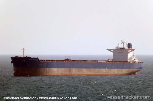
Alpha Liberty
Current StatusWhere is the vessel?
Alpha Liberty is currently in Near Cape Ray, based on AIS data received about 16h ago.
Latest AIS update:
Current position: 47.52076° N, 59.47319° W (Near Cape Ray)
Average speed (last 7 days): Loading…
Average speed (last 30 days): Loading…
Vessel profile: Alpha Liberty is a Bulk Carrier with dimensions 45m x 292m.
This page combines live AIS, route history, probable destination signals, nearby traffic, and port activity for practical vessel monitoring.
The current position of vessel Alpha Liberty is 47.52076 lat / -59.47319 lng. Updated: 2026-06-13 07:36:03 UTCNearest reference points:
- Near Corner Brook
- Near Goldboro
Details:
Live Vessel Alpha Liberty Analytics (details, animations, etc.)
Recent AIS points (UTC):
2026-06-13 04:07:52 UTC · 47.27058, -58.60495 · SOG 11.3 kn · COG 293°2026-06-13 05:49:11 UTC · 47.39895, -59.03636 · SOG 11.2 kn · COG 295°
2026-06-13 07:35:14 UTC · 47.51959, -59.47025 · SOG 9.9 kn · COG 302°
2026-06-13 07:36:03 UTC · 47.52076, -59.47319 · SOG 9.9 kn · COG 303°